
Description
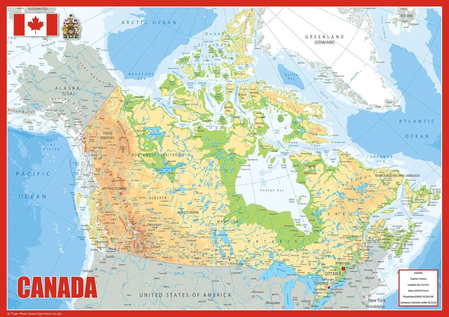
Explore the vast and varied landscape of Canada with this detailed physical map. Spanning from the Atlantic to the Pacific and reaching into the Arctic, Canada is the second-largest country in the world by total area and home to the world’s longest coastline. This map highlights the country’s ten provinces and three territories, featuring key cities like Ottawa, Toronto, Montreal, and Vancouver. Designed for clarity and educational value, it offers an in-depth look at Canada’s geography, including mountain ranges, rivers, lakes, and major infrastructure. Size: 23.3 x 16.5 inches Detailed physical terrain with easy-to-read labeling Includes capital cities, towns, rivers, major roads, and bodies of water Ideal for classrooms, offices, travel planning, or home display Printed on high-quality paper and finished with a durable gloss laminate A great reference tool and decorative addition to any learning or working environment, this map brings Canada’s vast landscape into clear focus. Explore the vast and varied landscape of Canada with this detailed physical map. Spanning from the Atlantic to the Pacific and reaching into the Arctic, Canada is the second-largest country in the world by total area and home to the world’s longest coastline. This map highlights the country’s ten provinces and three territories, featuring key cities like Ottawa, Toronto, Montreal, and Vancouver. Designed for clarity and educational value, it offers an in-depth look at Canada’s geography, including mountain ranges, rivers, lakes, and major infrastructure.
More Information
| Color | Green |
| Size | 23.3 X 16.5 Inches |
| Mpn | Canada-Phys |
| Age_group | ADULT |
| Condition | NEW |
| Gender | UNISEX |
| Product_category | Gl_office_product |
| Google_product_category | Office Supplies |
| Product_type | Office Products > Office & School Supplies > Education & Crafts > Geography Materials > Maps |