
Description
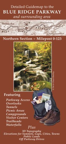
This is a two sided, folded, full color relief map. It is designed to act as your guide as you travel the Blue Ridge Parkway. The map shows Visitor Centers, trailheads, campgrounds, overlooks, tunnels and access roads. In addition, major recreation areas, Forest Service campgrounds, and waterfalls are shown. Plus, many backroads are detailed making this map an invaluable guide to scenic drives as well as a recreational resource for areas surrounding the Parkway. This map covers the Parkway from Roanoke, Virginia until its end, near Waynesboro, VA. Map scale is 1/2 inch = 1 mile. A portion of sales for this map goes to the Blue Ridge Parkway Foundation . Also available to purchase on Amazon, are the southern section and central section. You can also purchase the entire set of 3 maps or a set of two and save on shipping! Search Amazon for the special 3-pack, item number B001CZ4H9C, and two 2-packs of these maps.
More Information
| Gtin | 9780977091522 |
| Age_group | ADULT |
| Condition | NEW |
| Gender | UNISEX |
| Product_category | Gl_book |
| Google_product_category | Media > Books |
| Product_type | Books > Subjects > Reference > Atlases & Maps |